Photos for Capitol Reef National Park and
vicinity

Return to
Capitol Reef Photo Overview
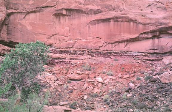
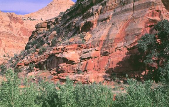
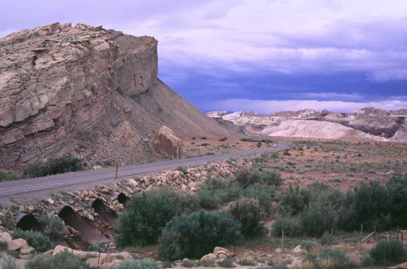
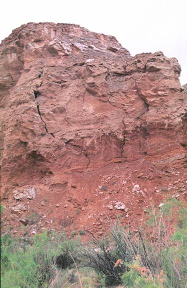
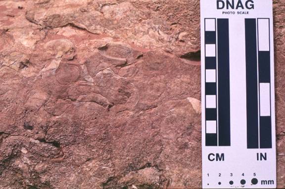
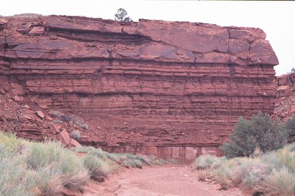
At the pullout just before
the Park entrance, between mileposts 89 and 90 you can see possible Saurapod
tracks (a trample bed) on the north side of the Fremont River (across the river
from the road). The trample bed is located in floodplain deposits just below
the resistant sandstone at the top of the photo. Both the floodplain and the
sandstone are part of the Salt Wash Member of the Morrison Formation.
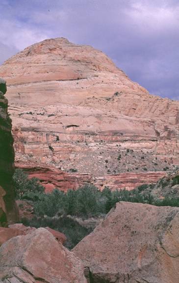
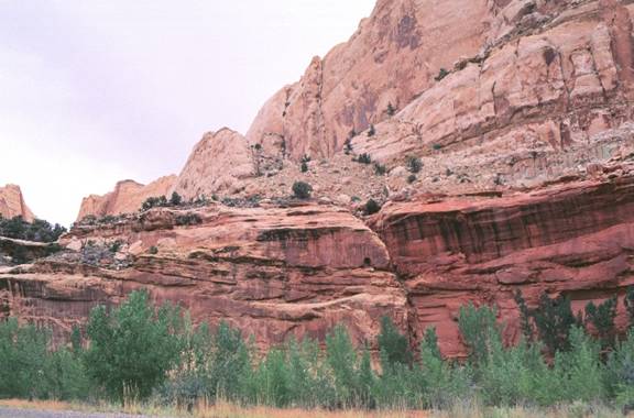
Navajo Sandstone
makes up the Capitol Dome in Capitol Reef National Park. Here it is as seen
from the Hickman Bridge Trail.
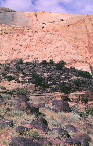
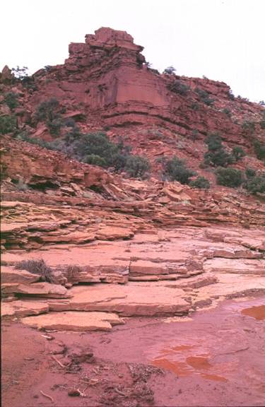
Basalt boulders
along Fremont terraces derived from the Aquarius Plateau. These are Tertiary
(?). They are remnants of the old Fremont channel.
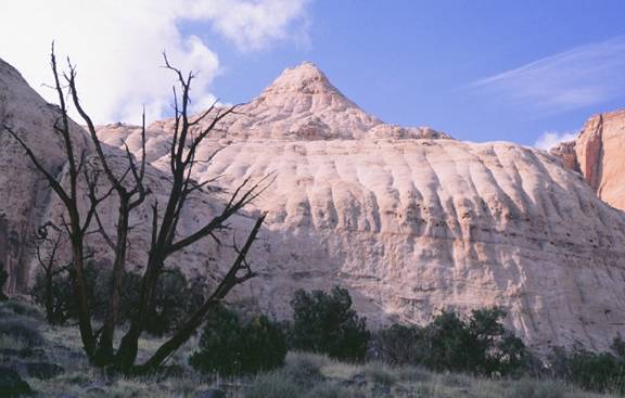
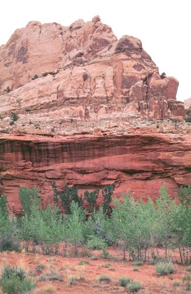
Navajo Sandstone
with joints with Entrada Sandstone at the top. The Navajo Sandstone here has
its typical rounded appearance.
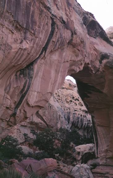
Hickman Bridge in
Capitol Reef National Park. As viewed from the west.
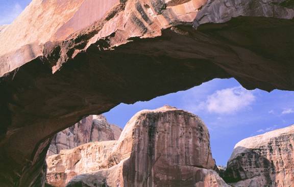
Hickman Bridge in
Capitol Reef National Park.
Hickman Wash in
Capitol Reef National Park.
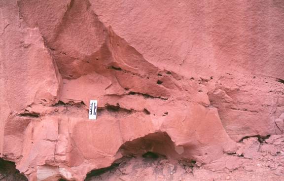
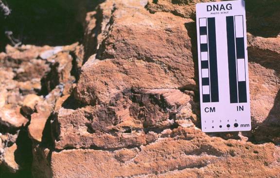
Mud lenses and
rip-up clasts that are now weathered out and outline cross bedding near Hickman
Bridge parking lot. These features are in the Jurassic Kayenta Formation.
Mud rip-up clast in
the Jurassic Kayenta Formation.
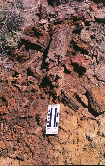
Petrified wood in
the Triassic Chinle Formation.
Outcrop of the
Chinle Formation along the north side of the road in Capitol Reef National
Park.
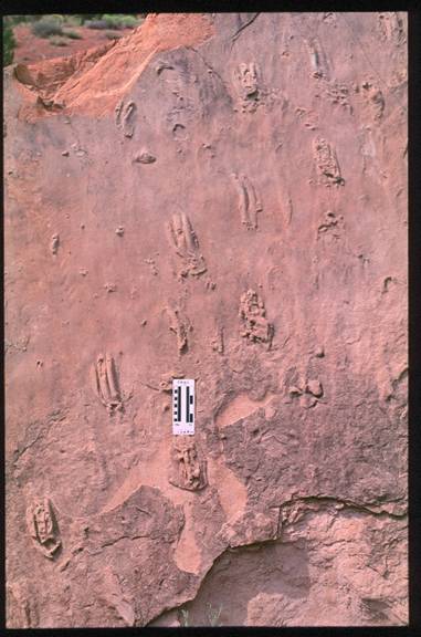
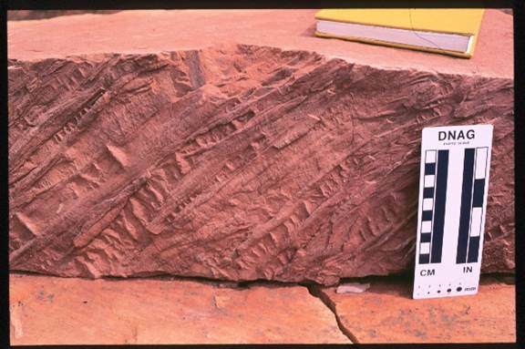
Tracks in the
Triassic Moenkopi (Moody Canyon or Torrey Member). This fallen slab is near the
pullout on the south side of the road just west of the Chimney Rock parking
lot. Hike towards the south to the wash and at the outcrop on the east side of
the wash look at the fallen slabs.
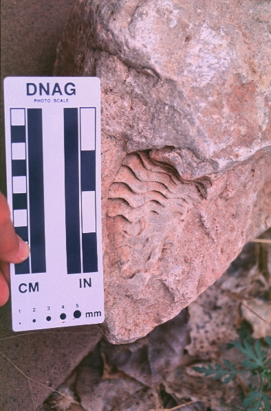
Plant fossils along
the base of a bed in a fallen block at the same site as described in previous
caption.
Fossil in block near cabin at Visitor's center.
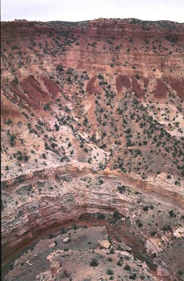
Grand Wash from
pullout to the hiking trail on the east side of the road. In the photo the
Triassic Moenkopi is at approximately road level, it is overlain by the
Shinarump Conglomerate, the rest of the Triassic Chinle Formation, and the
Jurassic Wingate Formation (the cliff former at the top of the photo).
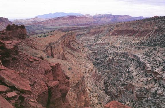
View from
Goosenecks Point. The Permian White Rim Sandstone is exposed at the base of the
cliff and it is overlain by the Permian Kaibab Limestone. The Kaibab is
unconformably overlain by the Black Dragon (lower), Sinbad (gold color), and
Torrey Members of the Triassic Moenkopi Formation.
Looking east from
Sunset Point. Stratigraphy as described in the above caption. This site is
located just west of the Waterpocket fold that marks the western boundary
between the desert and the high plateaus of the Colorado Plateau physiographic
provinc e. This is a good area to use the surrounding geomorphic features to
interpret the time of uplift of the Colorado Plateau and incision of the
streams that cut through it.
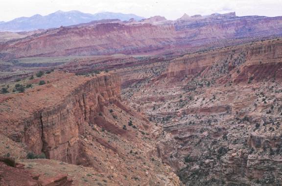
A slightly
zoomed-in version of the photo described above.
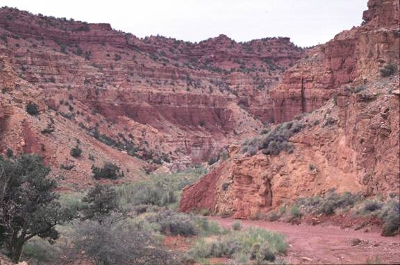
Permian Kaibab
Limestone in Suphur Creek Canyon.
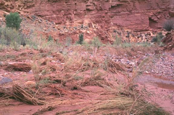
Permian Kaibab
Limstone in Sulphur Creek Canyon from Sulphur Creek. Note the bent strands of
grass that provide evidence of flash floods.
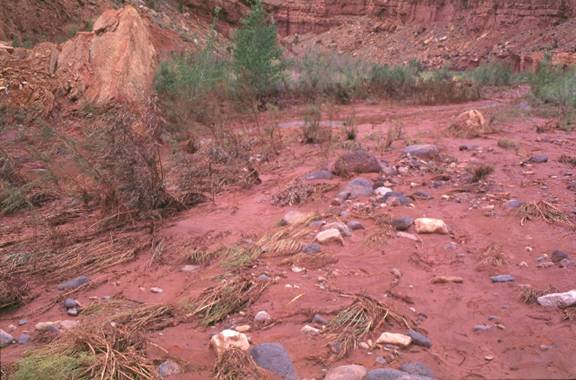
Evidence of flash
floods along Sulphur Creek.
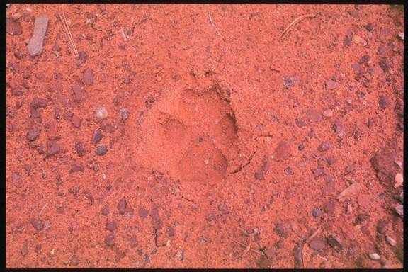
Coyote footprint
along Sulphur Creek floodplain.
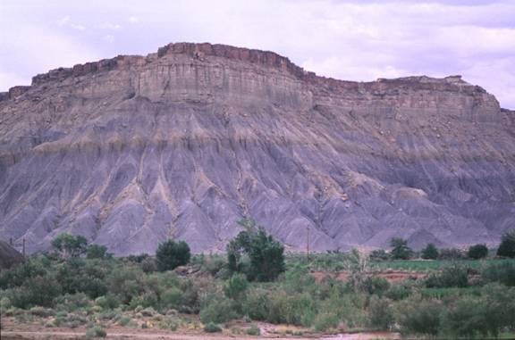
Emery Sandstone above the
Bluegate Shale Member looking east from Caineville Wash Road. Just past the
Caineville Inn.
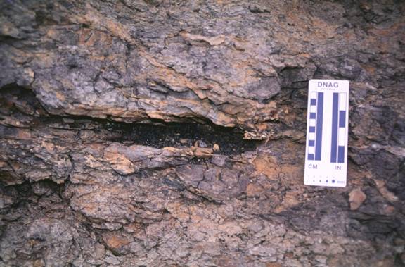
Coal in the Ferron
Sandstone along Caineville Road.
Ferron Sandstone
above the Tununk Shale above the Brushy Basin Member of the Morrison Formation
looking west from the Caineville Road.
Coal in the Ferron
Sandstone as seen from the Caineville Road.
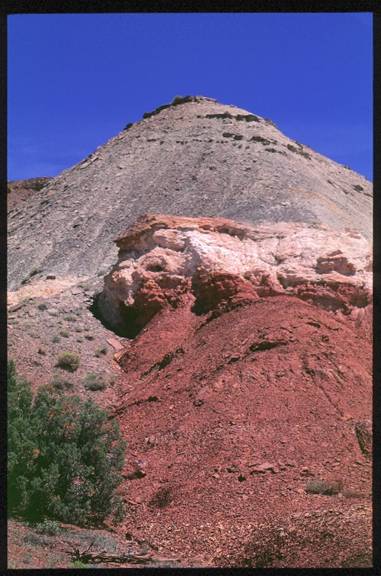
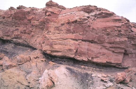
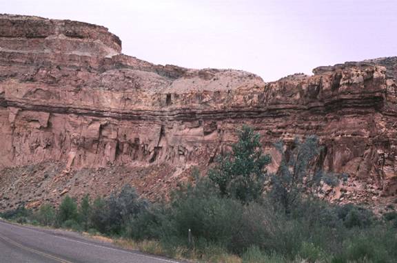
Jurassic rocks
exposed to the east of Capitol Reef. Red Summerville Formation is exposed at
the base of the outcrop and is overlain by the sandstone, red shale, and green
shale (respectively) of the Tidwell Member of the Morrison Formation. The
Tidwell is overlain by the resistant Salt Wash Member of the Morrison.
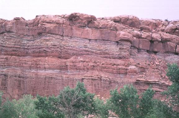
Jurassic rocks. The
Salt Wash Member of the Morrison makes up the white/grey cliff at the top of
the photo. The Tidwell Member of the Morrison is the grey/green slope former
below the Salt Wash. The Summerville Formation is the red slope former, and it
overlies the green slope-forming Curtis Formation, that in turn overlies the
red slope forming Entrada Sandstone.
Contorted bedding
in the Jurassic Carmel Formation, which underlies the Entrada.
Jurassic Navajo
Sandstone exposed at lower part of cliff overlain by a very resistant thin bed,
overlain by the Page Sandstone (gold sandstone with red shale), overlain by the
Carmel Formation.
Same strata
described in caption above, here the contact between the Navajo and the Page
lies in approximately the center of the photo.
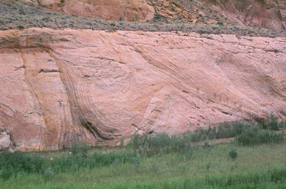
Large-scale
contorted and cross-bedded Jurassic Navajo Sandstone.
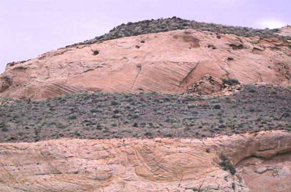
Large-scale
contorted and cross-bedded Jurassic Navajo Sandstone.
Contact between the
Jurassic Kayenta Formation (below) and the Jurassic Navajo Sandstone (white). A
channel is present within the Kayenta at this location.
Contact between the
Kayenta and the Navajo.
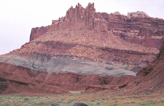
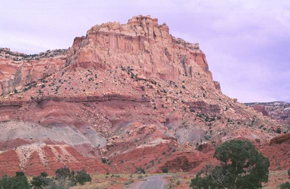
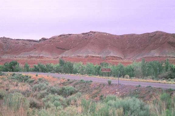
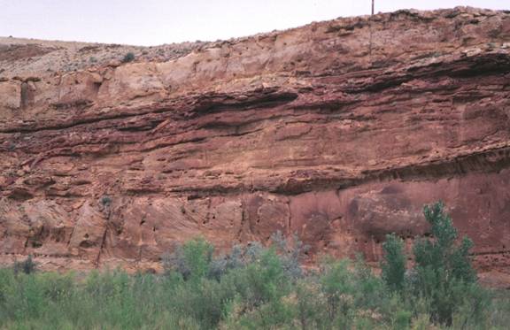
The red Triassic
Moenkopi is located at the base of the outcrop and it is overlain by the green,
then red, then ledge-forming, then lavender, then red Triassic Chinle
Formation. The cliff-forming unit At the top of the outcrop is the Jurassic
Wingate Formation.
Fossilized shells
in the Sinbad Limestone Member of the Triassic Moenkopi Formation.
Torrey Member of
the Moenkopi Formation. Paleochannels are present near the top of the outcrop.
Top of the Sinbad
Limestone Member of the Moenkopi Formation. It is a resistant unit that makes
ledges even within the wash channel.
![]()