Captions for Dinosaur National Park
![]()
Return to Dinosaur
Photo Overview
![]()
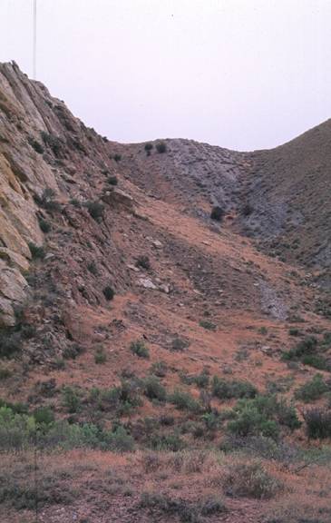
The Pennsylvanian
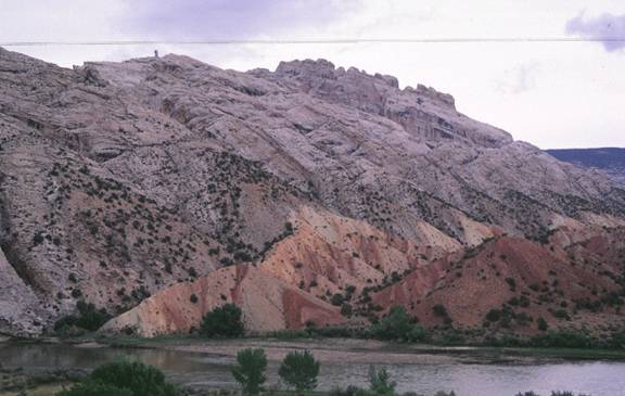
Weber Sandstone exposed along the Yampa River at Echo Park.
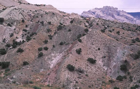
Jurassic Entrada Sandstone overlying Jurassic Carmel Formation. The Entrada is white and cross-bedded near its base and
horizontally bedded near the top.
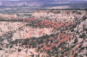
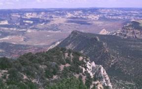
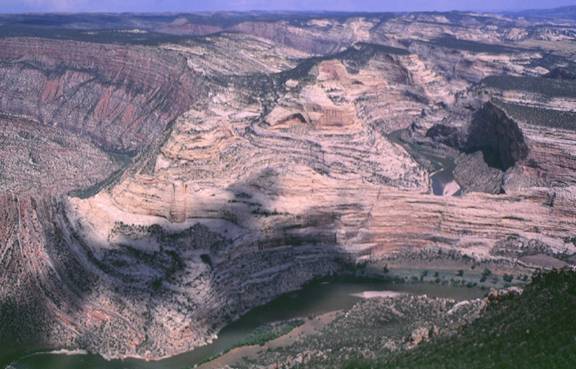
This is a three
photo panorama looking to the west from the Picnic area at Plug Hat Rock. In
the photos, the Glen Canyon Sandstone is in the foreground. It is whitish and
has steep canyons within it. It is overlain by the red Carmel Formation, and
the whitish Entrada Sandstone (also a cliff-former).
The grey hills in the middle distance are composed of the Curtis (lower) and Redwater (upper) Members of the Stump Formation. The Stump
is overlain by the Morrison and Cedar Mountain Formations. The Cedar Mountain
is lavender in color and has the Buckhorn Conglomerate at its base
(discontinuous conglomerate). The Cedar Mountain forms a flat bench in the
photos. The first photo in the panorama is the southernmost.
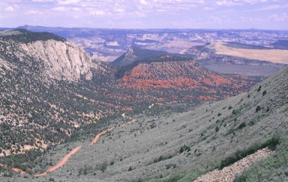
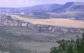
Giant
stair-steps down to the Yampa River from the Harper's Corner Drive. The Weber Sandstone is at the top of the hightest bench on the south. The next lower bench is topped
by the Park City Formation. The White Cliffs in the distance are again composed
of the Weber Sandstone. There are two faults in these photos, one fault on each
side of the middle bench. The Yampa Fault separates the upper bench of Weber
Sandstone from the Park City, and the Red Rock Fault separates the middle block
from the lowermost block of Weber Sandstone. The Yampa River runs in the canyon
between the bench capped by Park City and the lower Weber Sandstone bench. This
photo is taken from the Canyon Overlook and Picnic area along Harper's Corner
Drive.
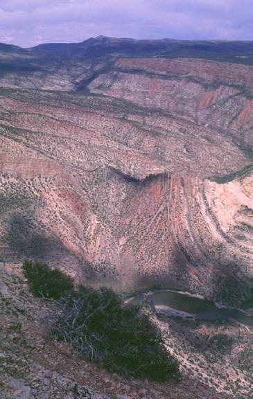
A
spectacular view from Harper's Corner Drive into the Yampa Canyon. Here the Pennsylvanian Weber forms a cliff
on the left side of the photo. The low area in the center of the photo lies
between the Mitten Park Fault and the Yampa Fault. The red area in the middle
of the photo has a cap of Triassic Chinle, and most
of the red material is the Triassic Moenkopi. The steep hill on the right side
of the photo rises to where it is capped by the Pennsylvanian Weber Sandstone.
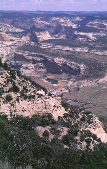
Three-shot panorama
of the giant faulted stair-steps down toward the Yampa River. On the far left
side a bench capped by the Pennsylvanian Weber Sanstone
tilts toward the Yampa River. The Weber is overlain by the Park City, which is
in turn overlain by the red Triassic Moenkopi Formation. The right side of the
Moenkopi bench is cut by the Red Rock Fault that places the Weber (on the right
side of the fault) in contact with the Moenkopi (on the left side of the
fault). The Weber is capped by a thin layer of Park City and the bench composed
of Weber and Park City is truncated on its right-hand side by the Yampa Fault.
The bench on the far right side is capped by more Weber sandstone and is at the
highest elevation of all the benches seen in these photos.
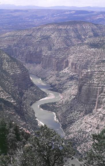
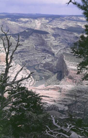
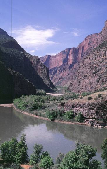
View from Harper's
Corner Drive toward Echo Park and the Yampa River canyon. The Yampa River, in
the vicinity of Echo Park, is cutting through the Pennsylvanian Weber
Sandstone.
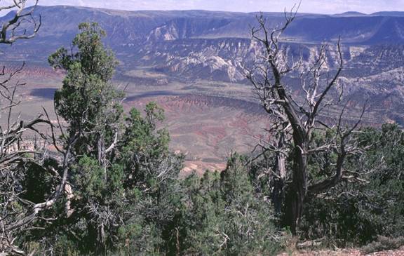
Green
River canyon to the west of Harper's Corner Trail.
Yampa
River canyon to the east of Harper's Corner Trail.
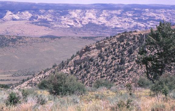
Tertiary
(Oligocene) Bishop Conglomerate at the crest of the hill on Harper's Corner
Trail. This conglomerate
caps mesas throughout the area and contains clasts
from the Uinta Mountains. It can be used to get an estimate of the time of downcutting of the Green River into its canyon in this
area.
Mitten
Park Fault from Harper's Corner Drive. What is the sense of motion on this fault? How can you tell?
A
natural arch in the Weber Sandstone. Note that the arch forms above a first-order bounding
surface and that water seeps from the horizon directly beneath the arch. Does
groundwater seepage contribute to arch formation. How
might it?
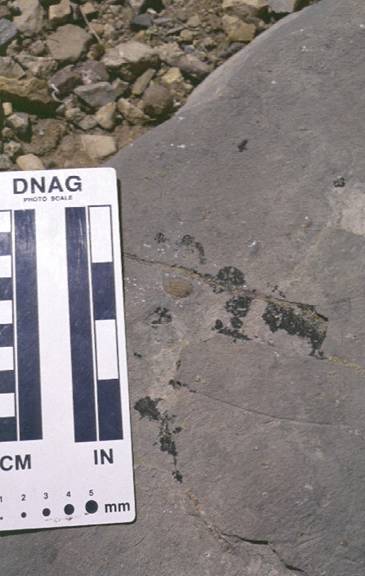
A
brachiopod in the Pennsylvanian Morgan Formation at Harper's Corner.
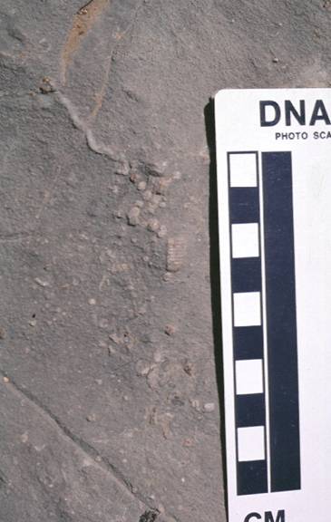
A
crinoid in the Pennsylvanian Morgan Formation at
Harper's Corner.
A
Pennsylvanian and Mississippian limestones in the
Green River Canyon as seen from Harper's Corner. The red and white cliff at the top is
composed of the Pennsylvanian Morgan Formation. The lower member of the Morgan
forms the uppermost bench. Between the first bench and the sheer cliff in the
central part of the photo lies the Round Valley Limestone (Pennsylvanian) and
the Doughnut Shale (Mississippian). The sheer cliff is composed of the
Mississippian Madison Limesone. The inner canyon, in
which the Green River runs, is composed of the Cambrian Lodore
Formation.
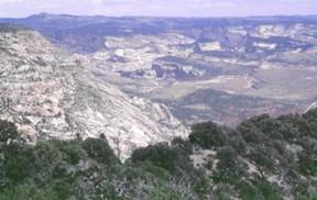
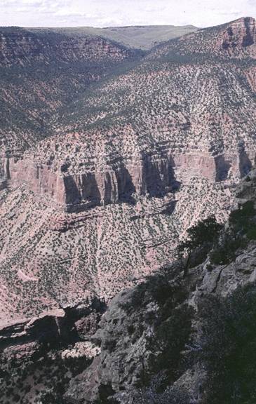
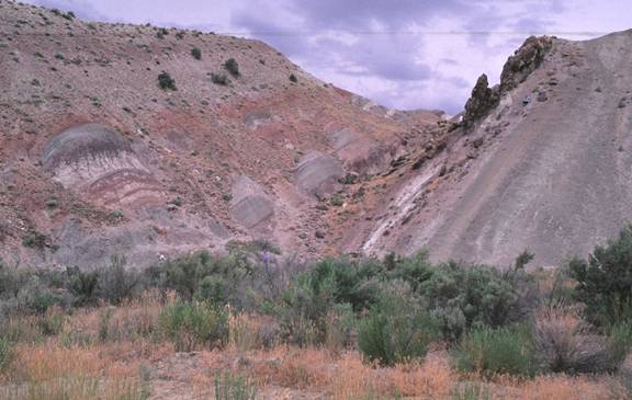
Stair-steps created
by the Yampa and Red Rock Faults exposed to the southeast of Harper's Corner.
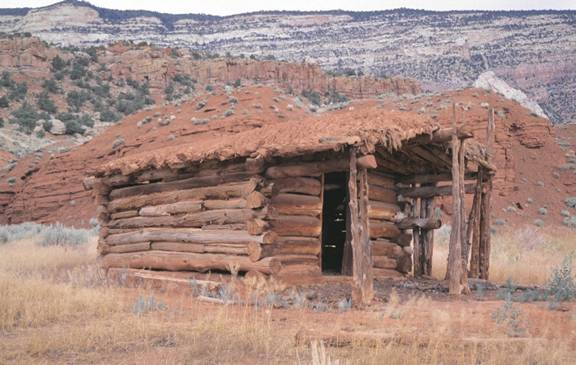
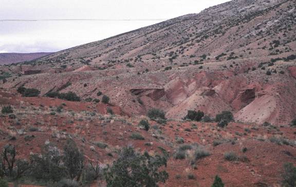
Homestead cabin in
Triassic Moenkopi Formation.
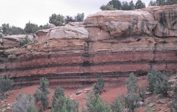
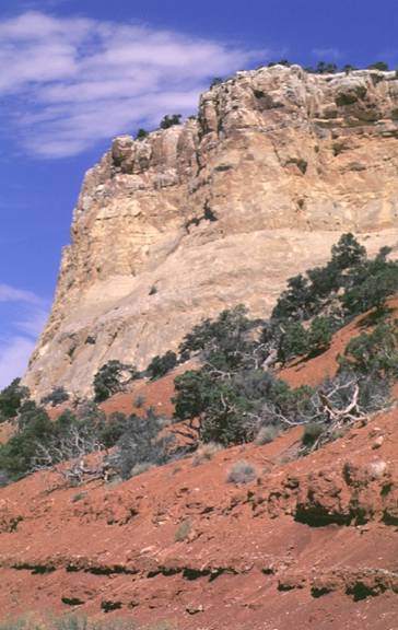
Triassic Chinle Formation overlying Triassic Moenkopi Formation on
the road to Echo Park.
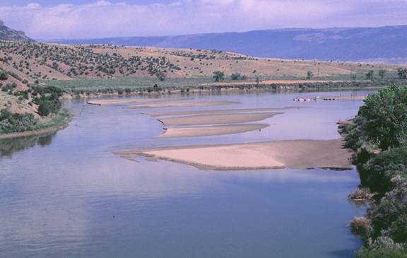
Transverse bars in
the Green River at Gates to Lodore.
Gates of Lodore with the Uinta Mountain Group (Yu) forming
reddish-colored cliffs.
Pebbly Uinta
Mountain Group (Yu) contains granitic clasts.
Looking east from
the dinosaur quarry doors you can see Jurassic strata. In the far left side of
the photo the resistant Entrada Sandstone is present.
The Entrada is overlain by the Stump Formation that
is divided into two members: the lower Curtis Member, and the upper Redwater Member. The Stump is overlain by the dinosaur-bearing
Morrison Formation that extends to the right side of the photo.
Looking west from
the road into the quarry you can see this view of the Morrison Formation. The
sandstone bed (resistant) in the center of the photo is the fossil-bearing unit
exposed in the quarry.
In this photo,
looking east from the road into the quarry, the Cretaceous Cedar Mountain
Formation forms the slope on the left hand side, the Cretaceous Dakota
Sandstone forms the resistant ridge in the center of the photo and the
Cretaceous Mowry Shale is present in the valley on
the right side of the photo.
Here the Cretaceous
Mowry Shale can be seen in a valley between the
Dakota and Frontier Sandstone ridges.
This is the Frontier
Sandstone that forms the prominent ridge that you enter as soon as you begin to
walk or drive to the quarry from the main parking lot. This ridge is very
extensive and is a good marker bed to use to keep track of your stratigraphic position when mapping in the area.
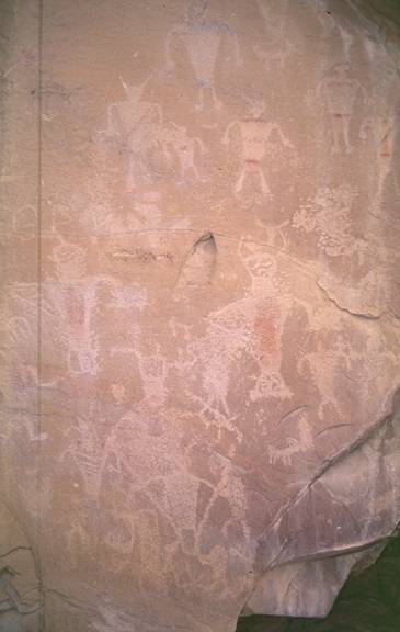
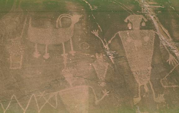
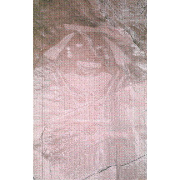
These are
pictographs (drawings on the rock) in a place called the swelter shelter.
More
pictographs in the swelter shelter.
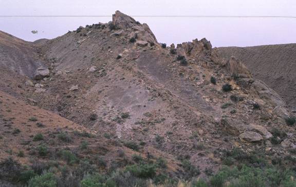
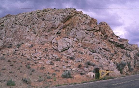
The
Permian Weber Sandstone, Permian Park City Formation, and the Triassic Moenkopi
Formation (from left to right in the photo). This is on the south side of Split
Mountain.
Pediment
on top of the Triassic Moenkopi along the Desert Voices Nature Trail.

Cross beds in the
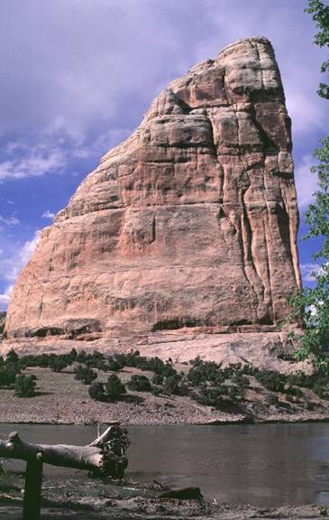
Jurassic Glen Canyon Sandstone at the Elephant Toes Butte.
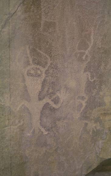
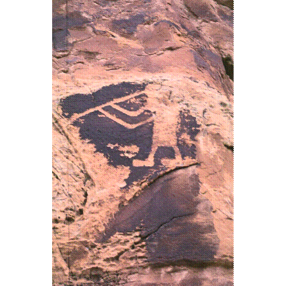
Pictographs and petroglyphs (carvings into the rock) along the dirt road on
the south side of Split Mountain.
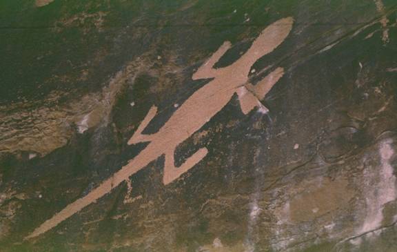
More
petroglyphs - here a lizard.
Kokopelli.
This face, and others like it are probably much older than the
Pre-Puebloan ruins that are present to the south near
Canyonlands.
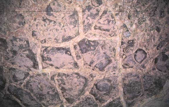
Mudcracks as they appear on the base of a bed.
![]()