More Photos for Unaweep Canyon

Return to
Unaweep Photo Overview
![]()
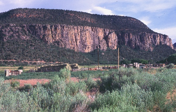
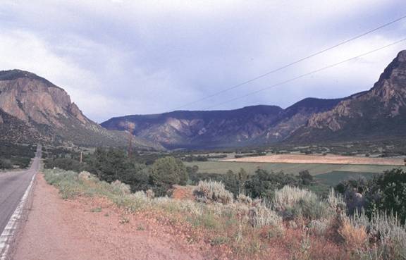
View of the contact
between the Uncompahgre uplift and the Chinle Formation. Relatively resistant
beds of the Wingate Sandstone are present along the skyline. This photo is
taken from Highway 141 looking toward Divide Road.
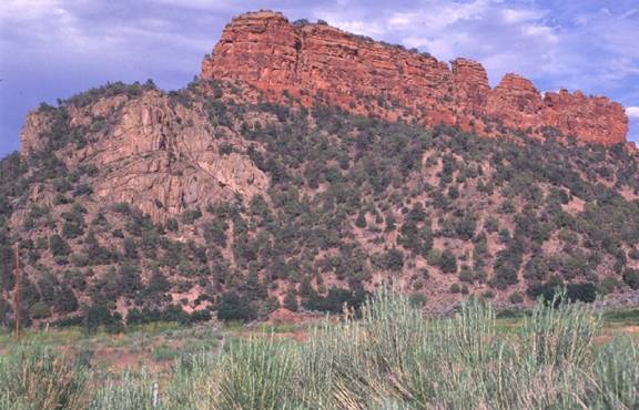
Purple-grey rocks
at the base of the photo are the Precambrian granite and granite gneiss of the
Uncompahgre. Note the prominent light-colored dikes. Above the igneous and
metamorphic rocks the nonresistant Chinle Formation is present. The
cross-bedded Wingate Sandstone is the resistant unit at the top of the photo.
This photo is taken near the junction between Divide Road and Highway 141. Why
are some rocks more resistant than others? What characteristics of these three
formations could make them differ in their resistance to weathering? How did
these different rock units form?
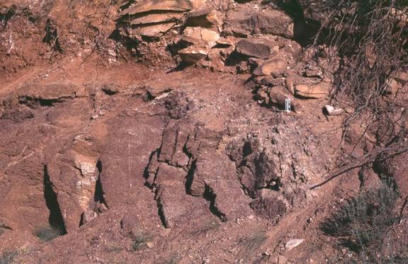
Close up of the
contact between the Uncompahgre and the Chinle Formation. Note photo scale in
center right of photo. Where exactly is the contact? Why do the two rock units
appear so similar?
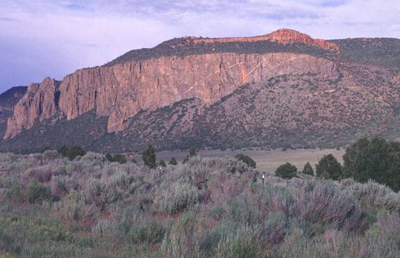
Prominent dikes in
the Uncompahgre Uplift. Chinle Formation directly overlies the Precambrian
uplift and Wingate Sandstone is present along the skyline. How does the
composition of the dikes differ from that of the rest of the Uncompahgre rock?
Did the dikes form before or after the surrounding rock? Where did the dikes
come from?
Unaweap Canyon is
extremely wide and is U-shaped. This canyon was probably not cut by glaciers,
so how did it form? Look at topographic maps of both the canyon and the
surrounding region (as far away as Grand Junction) before you decide.
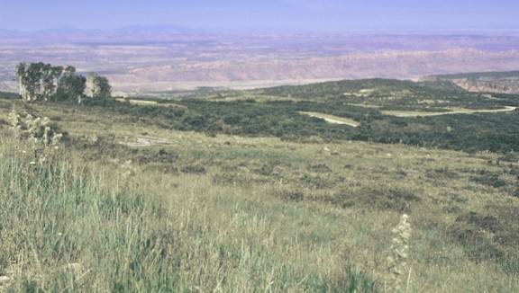
This view from the
top of the La Sal Mountains toward the west (into Canyonlands) shows that there
is a lot of red rock present to the west of the Uncompahgre. Much of this rock
came from the Uncompahgre originally. Can you estimate the original size of the
Uncompahgre Uplift?
![]()