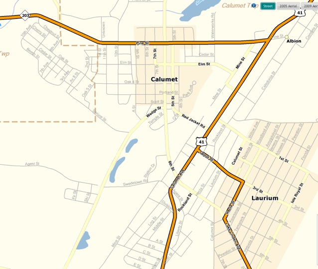
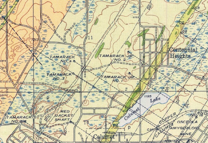

Street patterns in Calumet are N-S like many towns and cities. But Laurium and US 41 follow the strike of the Portage Lake Volcanics and the C & H Conglomerate in particular. It’s not an accident!
Surface contact
C & H Conglomerate
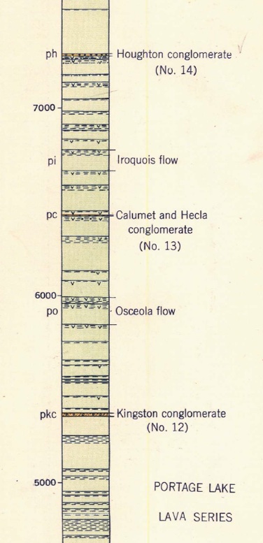
The C & H Conglomerate is a 25 ft thick layer which is the host rock for the copper mined along the black line above and its projection underneath Red Jacket (downtown Calumet). It is found within a sequence of 287 lava flows at the level indicated by the oval below.
The C & H Conglomerate dips down at about 55 degrees toward Lake Superior and Isle Royale, underneath Red Jacket. The deepest parts of the mine are thousands of feet below sea level.
This is a cross section of the sequence of layers, mostly lava flows (there are 287 lava flows in the whole section at Calumet!). The conglomerates are important to the copper deposits as they typically can be mineralized with copper.
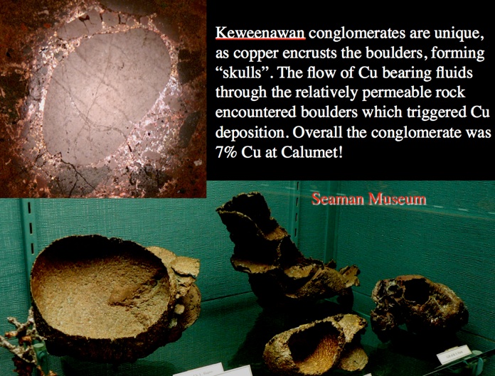
The conglomerates were numbered from bottom to top so that they could be correlated from place to place. #13 was a lucky number-- It contained up to 7 % native copper. It marked the C & H Conglomerate (up to 25 ft thick) which was the richest of all and the most consistent. It was mined to great depth and left a huge mined out area underneath Red Jacket. The shafts that cross through along Mine Steet in Calumet, behind the High School and on to Osceola and beyond mark the trace of this conglomerate.
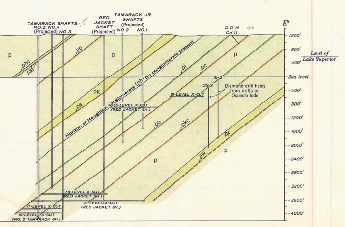


Projection of mined out area along C & H Conglomerate
C & H Conglomerate

deep stopes
shallow stopes
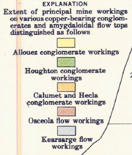
North of Calumet there are several mined out layers which reflect different mineralized layers including conglomerates (Allouez #15; Houghton #14) and amygdaloid flow tops (Osceola and Kearsarge).

North of Calumet Lake, the Greenstone Lava flow, largest by volume of the Lava flows of the Portage Lake Volcanics, runs through the area, making a slight ridge and cropping out at the surface. This is one of Earth’s largest lava flows.