Fault History
Discovery of the fault
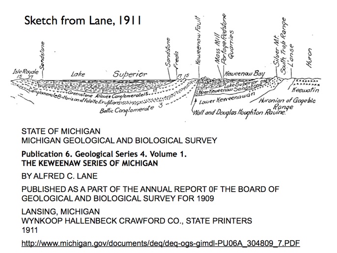

Above diagram from Lane 1911 integrates the Keweenaw Fault into a regional geologic/tectonic scheme which shows the Lake Superior Syncline (Midcontinent Rift Vally). Understanding the Keweenaw Fault was important in getting the big picture.
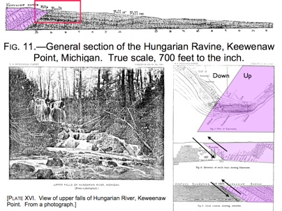
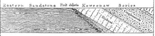
A USGS report published in 1885 first interpreted the fault location at Upper Hungarian Falls (see left). In those diagrams the older, upthrusted lavas and conglomerates are in violet and the sandstones in white.
Area of Hungarian Falls is shaded pink in these diagrams.


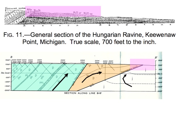
Jacobsville SS
Portage Lake Volcanics
Cornwall & Wright, 1956, Geology of Laurium Quadrangle USGS Mineral Investigations Field Studies Map MF 47
Cross section of Keweenaw Fault at Upper Hungarian Falls (Irving & Chamberlin, 1885)
1. The Fault 2. Dam 3. Crossbedding 4. Potholes 5. Plunge Pool 6. Bigger River? History