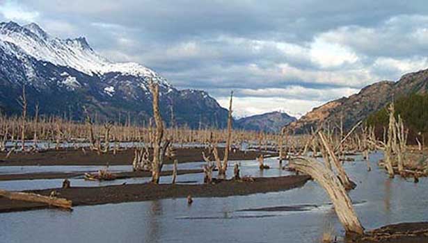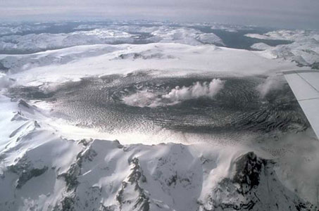
Figure 1. The ice-covered caldera of Cerro Hudson.
|
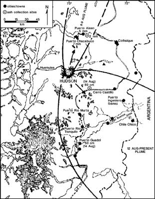
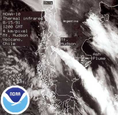
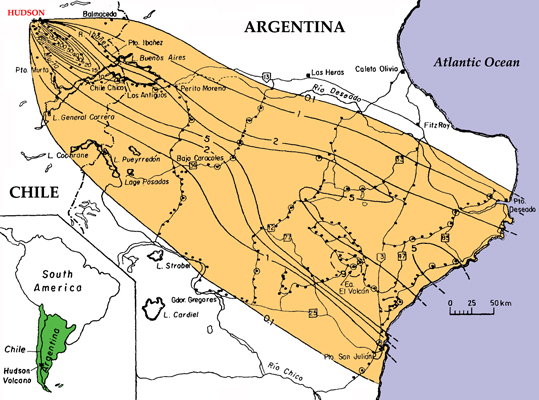
Cerro Hudson, Patagonian Andes Cerro Hudson is a historically active stratovolcano reaching 1905 m above sea level. It is the southernmost volcano in the Chilean Andes, and is related to the subduction of the Nazca plate under the South American plate. The Hudson volcanic complex consists of a 10×7 km caldera (Figure 1) with several vents covered by Patagonian glacier ice [Naranjo et al., 1993]. Historical Eruptions An eruption around 5000 yr B.P. (VEI 6-7) wiped out all existence of early man living in Central Patagonia at that time [Los Toldos archaeological site; Cardich, 1985]. On August 12th 1971, Hudson erupted (VEI 3) producing a plinian column 7-14 km high that dispersed tephra over an area of 60 km2, causing significant crop and cattle damage. The volcano erupted again on 23rd August 1971, sending a plume to ~6 km. Glaciers atop the volcano melted and produced lahars that claimed the lives of many people, much livestock and destroyed 80% of arable land in the Huemules valley (Figure 3; [Smithsonian Global Volcanism Program; Bitschene, 1995]). August 1991 eruption Cerro Hudson erupted most recently in two separate, partially sub-glacial phreato-plinian cycles on August 8th (starting at 18:20 CLT) and on August 12th 1991 (starting at 12:00 CLT). The first cycle was mainly basaltic, erupting tephra consisting of trachyandesitic and sideromelane glasses. The second cycle was characterised by the paroxysmal eruption of trachyandesitic and ryhodacitic material [Bitschene & Fernandez, 1995]. The August 8-9th eruption produced an ash column 7 to 10 km high (Figure 2), which subsequently rose to 12 km. Ash was dispersed by winds to the NNE (Figure 3). Thunder, lightening, black fall-out ash and a sulphurous odour were noted at Pto. Chacabuco and Pto. Aisen (Chile) about 30 minutes after the onset of the eruption. The eruption melted the capping glacier and produced lahars that traveled down the Huemules Valley, transporting meter-sized blocks up to 20 km from source. In one of the largest eruptions of the century, Hudson erupted again between August 12-15th, producing a column 18 km high. Ashfall was observed on the Falkland islands (~1,000 km SE; Figure 5), and covered a total area of ~80 000 km2 (Figure 3 and 5). DRE (dense rock equivalent) tephra volume estimates range between 2 and 6 km3: >1 km3 was deposited in Chile, around 2 km3 in Argentina, and 2 km3 may have fallen in the Atlantic Ocean or been lost to the atmosphere. Satellite data showed that the eruption produced a large SO2-rich cloud, estimated to contain 1.5 megatons of SO2 on 16 August, which was transported twice around the globe in 2 weeks [BGVN 16:08]. |
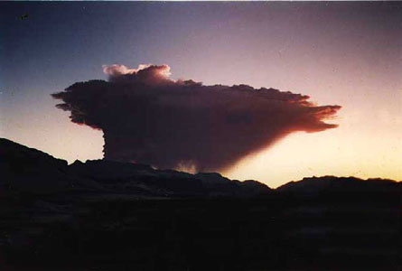
Figure 2. Eruption cloud at 19.30 CLT on 8 August 1991 as viewed from Coyhaique, Chile.
|
Figure 3. Distribution of ashfall layers from 8-9 and 12-15 August 1991 eruptions. |
Figure 4. TIR image of eruption cloud at 1200 GMT on 15 August 1991 (NASA image). |
Figure 5. Isopach map of the 12-15 August ashfall [Scasso et al., 1994]. |
