|
The Huron Creek watershed is an approximate 3.4 square mile watershed located in north central Houghton County in the Upper Peninsula of Michigan. The watershed empties into Portage Lake, which is connected to Lake Superior by a canal to the north and by a dredged channel in Portage Lake to the south. Portage Lake and the associated canal cuts the Keweenaw Peninsula, which extents out into Lake Superior, into two. Land within this watershed includes concentrated urban development associated with the City of Houghton and Portage Township, and the villages of Dodgeville and Hurontown.
|
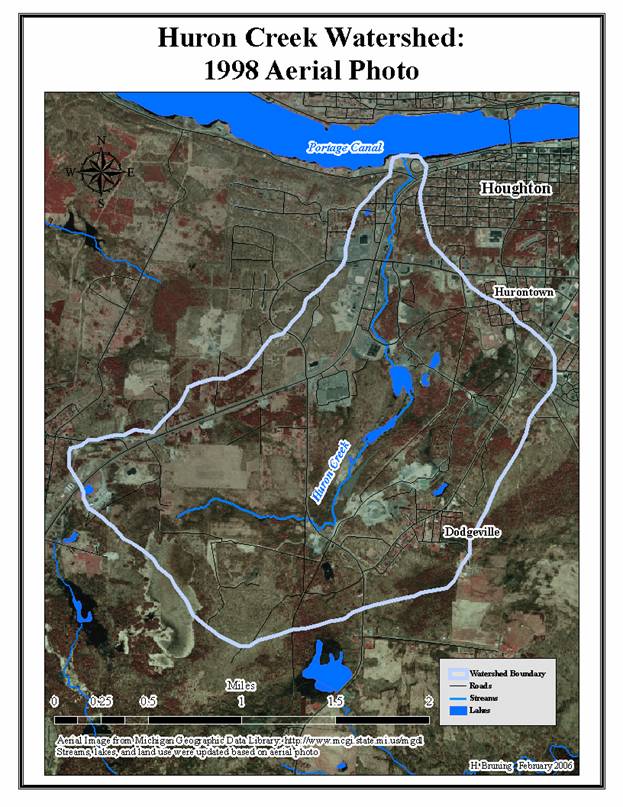
The main stream in the watershed, Huron Creek, is routed through multiple culverts and is approximately 3.3 miles in length. The creek’s source is in an area of wetlands located in the southwest corner of the watershed. The creek then flows to the east and north, and empties into the Portage Canal at the watershed’s northern “tip.” Huron Creek flows through areas of generally level to slightly sloping surface topography in the south and central portions of the watershed. Ground surface topography becomes sloping to steep in the north central part of the watershed near Sharon Avenue. Downstream from this area, Huron Creek passes through a narrow wooded corridor and underneath Michigan highway M-26. Lastly, before emptying into the Portage Canal, the creek passes through a popular waterfront park and recreation area.
| HOUGHTON COUNTY |
|---|
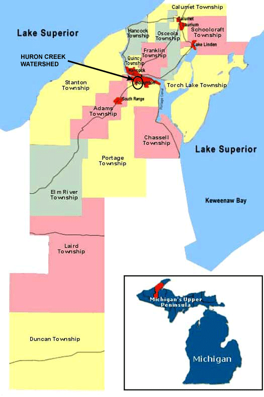
The following shows (a) the location of Houghton County within the state of Michigan; (b) the location of Portage Township and the City of Houghton within the county; and (c) the location of the watershed within Portage Township and the City of Houghton.
 |
www.coppercountry.com/ HoughtonCounty.php |