|
PROPERTY OWNERSHIP ALONG STREAM |
|
The following data and maps associated with property ownership along Huron Creek comes from a report prepared by Steven McManus. The main purpose for collecting this information was to determine the plausibility of adding public access sites and/or a potential nature trail along portions of the creek.
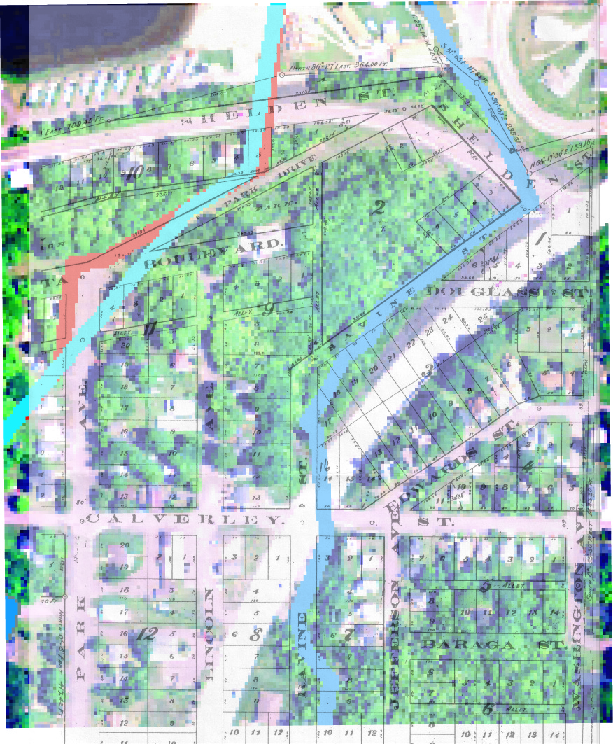
Figure 1 is a map that shows property lines in the section of the stream around Dakota Heights. See the ownership key (which is an excel spreadsheet) for the owners of that property. Fig. 1. Property boundaries in the area around Dakota Heights
Figure 2 is a map that shows property lines in the section between the former Lake Huron and Dakota Heights. See the ownership key for the owners of that property. Fig. 2. Property boundaries in the midsection of watershed
Figure 3 is a map that shows property lines in the upstream portion of the watershed . See the ownership key for the owners of that property. Fig 3. Property boundaries in the upstream portion of the watershed
Be aware that the information used to compile these maps came from multiple sources, including include the 2006 Houghton and Keweenaw county plat book, the City of Houghton, and Portage Township. Not only do the sources of this information vary, but also the date the information was published. In addition, the maps have been constructed to show a rough estimate of property lines and should not be considered precise. |