Intensive commerical development in the portion of the watershed above Sharon avenue began with the construction of the new M-26 corridor in 1979. It is expected to continue at a steady pace for the foreseeable future. Based on the Huron Creek Land Use study, “developed” areas (commercial, industrial or dense residential) in the entire watershed have increased by the following percentages:
| Years |
Percent
Change in “Developed Area” |
1978-1998 1998-2005 Overall since 1978 |
|
Estimates of change in total impervious area for these years are:
| Years |
Percent
Change in “Developed Area” |
|
1978-1998 1998-2005 Overall since 1978 |
|
This trend suggests that the area covered by impervious surfaces in the watershed is increasing by approximately 0.4% per year. The area east of the Country Inn and Suites is already zoned for development, with the target being light industry. The City of Houghton also has plans for additional roads in this area. Farther up the watershed near Dodgeville, a quarry is expected to be closed and replanted with vegetation. In the coming years, residential areas are expected to be developed in the same area.
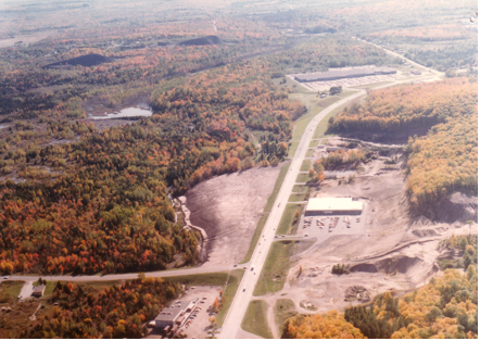
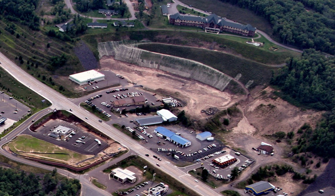
| This view from the mid-1980s, looking south, shows the watershed in the period just after the new M-26 was constructed. Note that Kirkish Furniture (on the right) and the Copper country Mall (at the top) are already constructed. The landfill on the left of M-26 has been covered and is ready for development. The area north of Kirkish Furniture (where Econo Foods & Shopko are now located) supplied the fill required for the water front park. The former Huron Lake and piles of stamp sand (site of quarry) can be seen in the upper left. | This current view of the area just south of Kirkish Furniture shows some of the development that has occured west of M-26. (Kirkish is located just out of view at the bottom.) The Bluffs retirement community can be seen on the hill overlooking the area. |
|
City of Houghton files |
Moyle Construction |
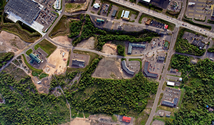
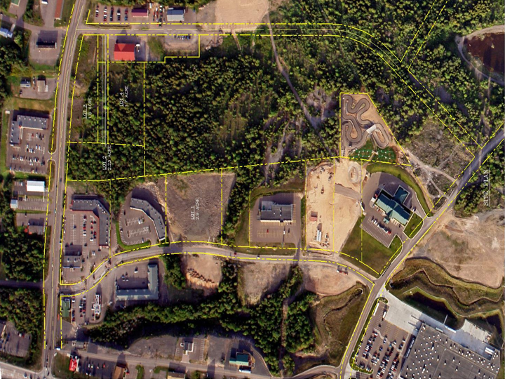
| This 2006 view shows the development that has occurred in the area east of the landfill. Walmart can be seen in the upper left. (The view is westward-looking, with the old landfill at the top of the photo and Kirkish Furniture just out of view across M-26). | The City of Houghton has plans for an additional roads in what is now called the Razorback business area. The roads are shown in yellow at the top. (In this view, looking eastward, the landfill area and Walmart are at the bottom, with M-26 just out of view below them.) |
|
Moyle Construction |
Moyle Construction
|