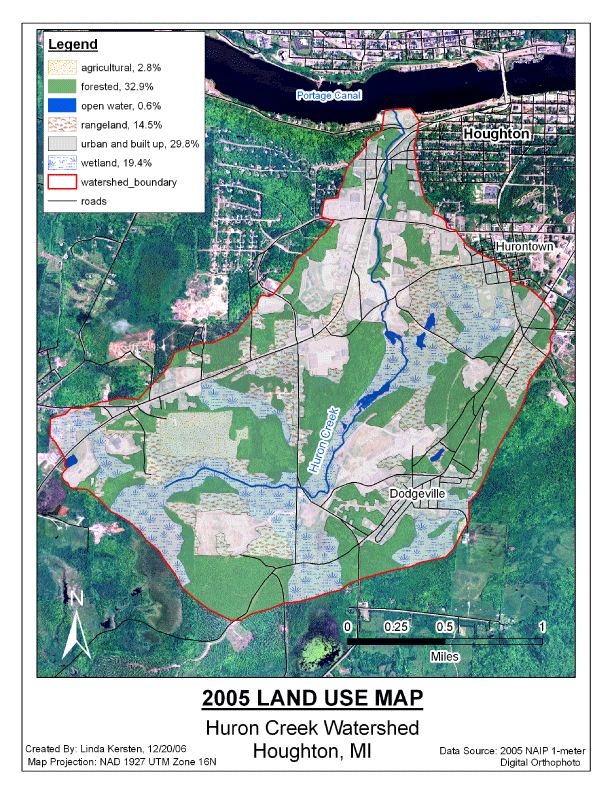
The wetlands in the watershed are shown in the following land use map. Almost one-fifth of the watershed consistes of wetlands. Data sources for these wetlands include MIRIS Land Use Data and the USFS National Wetland Inventory Data. Wetland locations and sizes have not been field verified.