In the first half of the twentieth century, the land in and around what is now the Waterfront Park was the location of railroad lines and coal docks. The most prominent structure, shown below, was a railroad roundhouse in which train cars were serviced. At that time, Huron Creek discharged further to the west, emptying into Portage Lake at what is now Houghton Beach. When the roundhouse was demolished and the Waterfront Park created, the outlet of the creek was relocated to where it currently resides. Needless to say, the area around the mouth of the creek was once highly industrialized and has since been remade into a peri-urban environment.
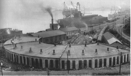
| Copper Range Roundhouse (circa 1900) The current waterfront park lies just to the west (left in picture) of the roundhouse. |
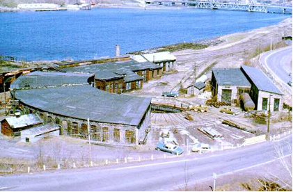
Copper Range Roundhouse (1974) The roundhouse being demolished, with leveled portions and abandoned sections. |
|
|
|
|
Michigan Technological University archive |
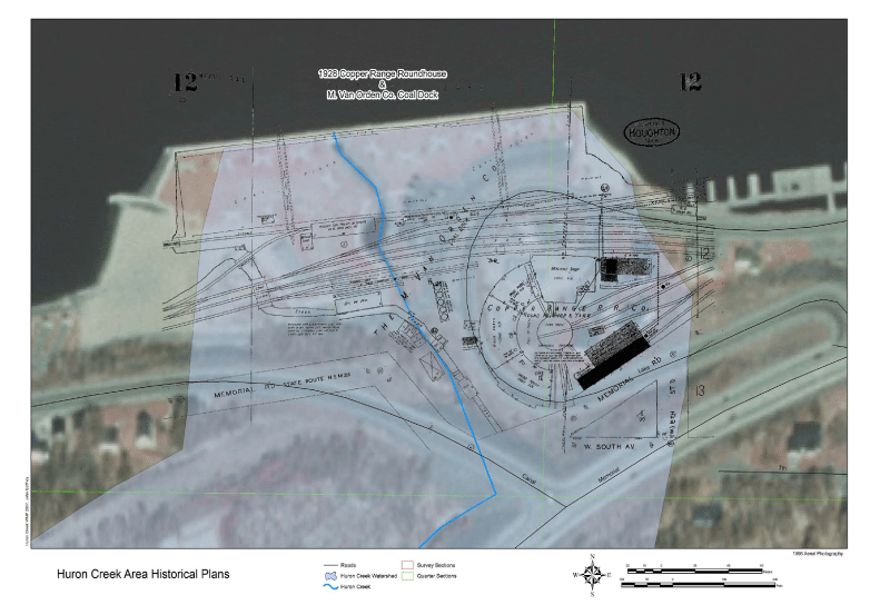
| LOCATION OF STREAM RELATIVE TO ROUNDHOUSE |
|---|
This figure (created by John Gaffney) shows the roundhouse (from a 1928 Sanborn map) overlaid with an aerial photograph from 1998. This map shows the creek (in blue) relative to the roundhouse and drives home the point that land around the mouth of Huron Creek has been significantly altered by human activities. A coal dock can be seen occupying much of the land that has been made into a park. Houghton beach, which is where the stream previously discharged, can be seen on the left.
| PLANNING |
|---|
The following is based on a conversation that John Gaffney had with Scott MacInnes and Jeff West of UP Engineers and Architects about the construction of the park:
• The park was built on the old coal dock and round house properties in 1988. At that time the area had been cleared of any industrial debris and had reverted to a ‘swamp’ according to Mr. MacInnes. This swamp area may have been essentially a newly forming delta for Huron Creek.
• Due to the sites grading before construction and the extremely wet conditions a considerable volume of fill was required to grade the site to current conditions. According to one plan sheet,a volume of 110,000 cubic yards of material was necessary. This fill was borrowed from the ShopKo and Econo Foods Locations along M-26. The fill material, from photographic evidence, was clean sand. This effectively makes the park a sand box.
• The creek channel has undergone several (approximately 4) redesigns since its realignment in 1988. Each modification was an effort to control erosion problems and reduce negative human interactions. Photographic evidence is available from the City of Houghton. The plans and construction have traditionally been a joint effort between city engineers and a local consulting firm.
• The city RV park is a source of revenue for the Cities’ general fund. This fund may be a possible funding source along with more specific park improvement funds.
• The “Chutes and Ladders” area was an addition to the park made in 1992. The hill that is it built on was excess fill material from the ShopKo source.
• Annual park maintenance includes removal of sediment from the pond by backhoe and dump truck. The city has also prescribed cutting of grasses and weeds down to the channel bottom along the creek banks.
• In April of 2007 the City will begin to develop its five year park plan. Mr. MacInnes would like the WAC input on park improvements as soon as possible.
• U.P. Engineers and Architects is currently looking for additional plans detailing the City of Houghton Waterfront Park. Jeff West may also have additional detailed topography and planning maps for land in the watershed.
| CONSTRUCTION OF THE PARK |
|---|
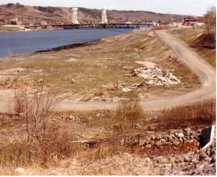
Before the Waterfront Park and boat docks were established and after the railroad removed its infrastructure, the shoreline and what is now Waterfront Park were no more than a strip of dirt and grass, as these two photos document.
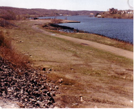
A view looking east from Canal Rd., notice the remnants of the Copper Range roundhouse (faint depressions and slab marks). Also note the culvert headwall in the lower right; this is still how Huron Creek goes under Canal Rd. The road in the photo will be paved and become Lake Avenue. Date of photo is pre 1987 but after 1976. |
Another view, looking west, along the old Copper Range Rail Road property. The former coal dock and current location of the West Houghton Waterfront Park is in the top of the photo. (Date pre-1987) |
|
|
|
|
City of Houghton files |
City of Houghton files |
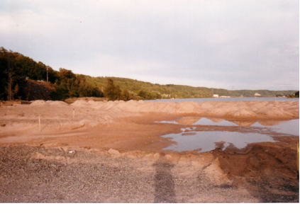
Later, this same area was planned for improvements that included the boat docks and Waterfront Park. Before the Waterfront Park could be constructed however, the land had to be raised and filled in with material to avoid flooding and swamp conditions, so sand from the hillside behind ShopKo was transplanted to Waterfront Park. In essence, Waterfront Park is a large sand box covered with sod.
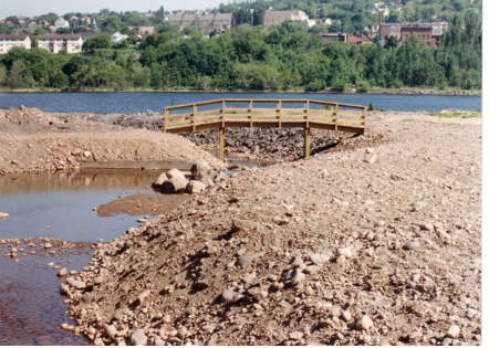
| Photo below shows the fill operation required to bring the coal dock area to the desired grade. This photo was taken during the start of construction in 1988. | A view of the arched wooden pedestrian bridge looking towards the outlet of Huron Creek through the old coal dock. |
|
|
 |
| City of Houghton files | City of Houghton files |
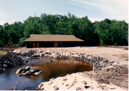
Notice the mine rock used to stabilize the sand channel banks. Also the rock pile in the pond provided a location for a fountain. The pavilion in the photo used a concrete slab from the original industrial operations on the site. |
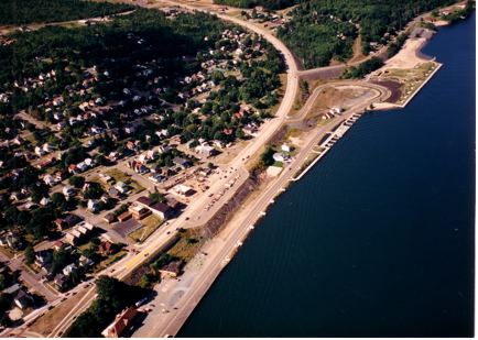
This aerial photo shows west Houghton’s waterfront soon after development (1988). Note that the old M-26 route is still visible between Canal Rd and the new M-26 alignment. |
|
|
 |
Photos of the park construction were provided by the City of Houghton and digitally scanned in by John Gaffney at a resolution of at least 300 dpi. The complete set of original park plans are archived at U.P. Engineers & Architects in their Houghton office.