Areas of RSI Research Expertise


Remote sensing is an interdisciplinary field which is best done with teams of specialists. At Michigan Tech expertise is in:

Biological Sciences/Chemistry
Biosphere and limnological applications

Civil & Environmental Engineering

Atmospheric chemistry, air pollution, earth systems, hydrosphere and soils applications

Electrical Engineering

Digital image processing, radio astronomy, electromagnetics, radar and microwave systems, signal processing, applied optics

Forestry

Digital image processing, geographic information systems, natural resource management applications, air photo interpretation

Geological Engineering

Atmospheric remote sensing, geophysical remote sensing, subsurface visualization, earth systems applications

Mathematics

Fourier series, linear algebra, parametric and nonparametric statistics

Physics

Atmospheric physics, electromagnetics, optics, meteorology, astronomy

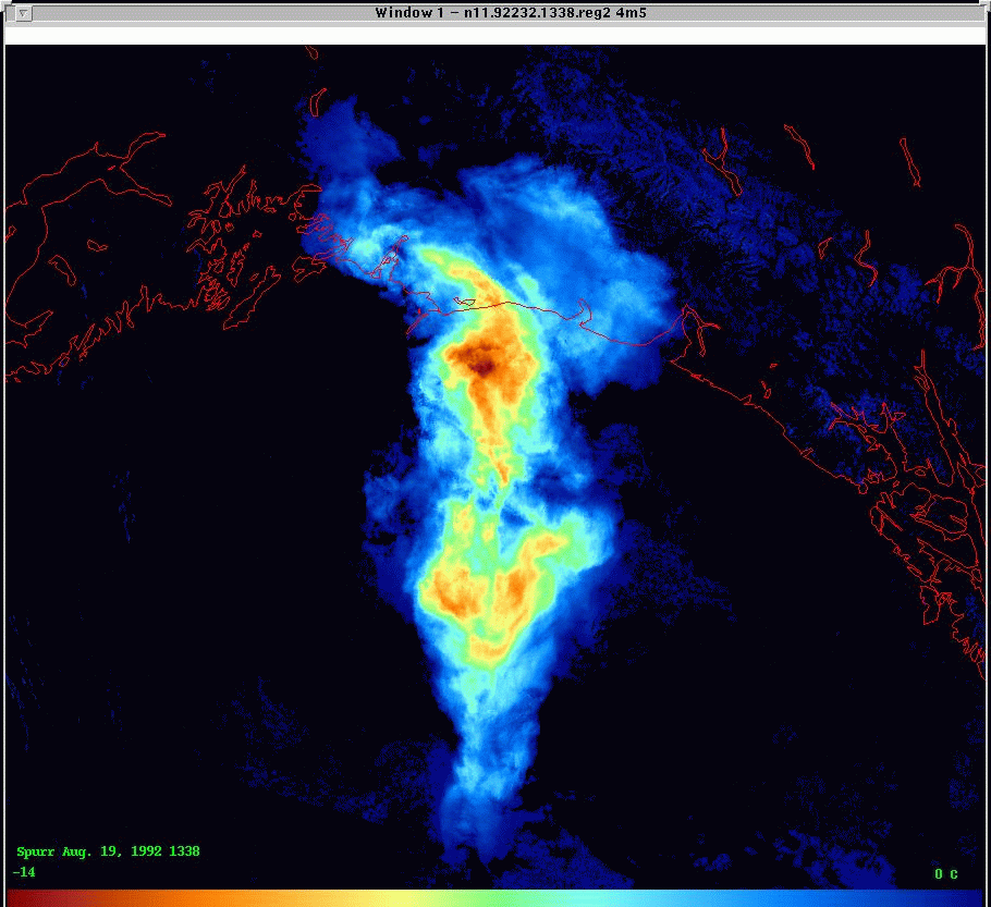
This AVHRR image shows the volcanic ash cloud from the August 1992 eruption of Mt. Spurr, Alaska. MTU researchers are collaborating with the USGS, NOAA, NASA and the FAA in efforts to reduce aircraft hazards through better detection and prediction of drifting ash and gas clouds.


Back to Main Page

Back to the Remote Sensing Institute Home Page