An Interdisciplinary Minor in Remote Sensing at Michigan Tech
Gregg J.S. Bluth, William I. Rose (Geological Engineering and Sciences)
James B. Rafert (Physics)
This overview was first presented at the Fall 1998 AGU meeting in San Francisco, CA
Overview of the Remote Sensing Institute (RSI)
Personnel
Resources of RSI
Areas of RSI Research Expertise
The Remote Sensing Minor Program
Purpose and Benefits
The Cornerstone Class: Introduction to Remote Sensing
The Remote Sensing Seminar Series, UN401
Coursework Offerings
Back to the RSI Home Page
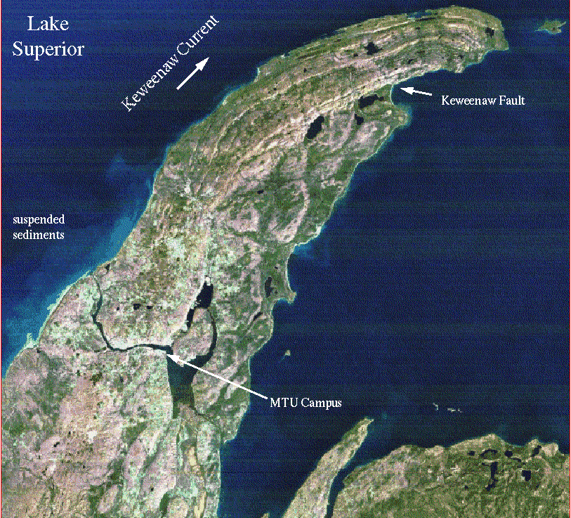 This Landsat Thematic Mapper image of Upper Michigan's Keweenaw Peninsula displays vegetation as pink and green shades and water as dark blue. The highly reflective areas (white) include roadways, buildings, and exposed rock and sand. Michigan Tech researchers use such images to study geologic structure, seasonal changes in vegetation, and the Keweenaw current, which transports offshore suspended sediments clockwise around the Keweenaw Peninsula.