Lava 2013

It may surprise people that here in the UP, far from active volcanoes, we find the world’s greatest known outpouring of lava, a great flood basalt, which led to the largest lava flows on Earth. The outcrop here is a typical one which represents the rock underlying all of downtown Houghton. There are more than 200 lava flows piled on top of each other, with the oldest located in East Houghton and the younger ones westward. At this place you can see the tilted layers and the black color of basalt, the name we give to the most common type of lava on Earth and other planets.
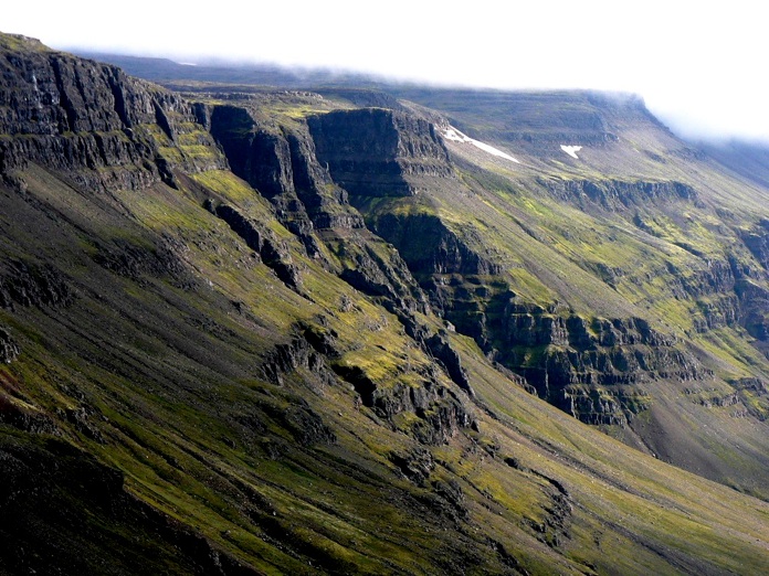
Eastern Iceland
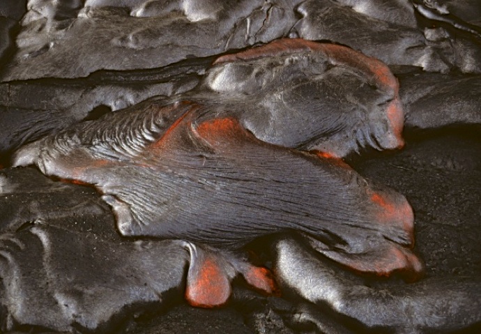
Hawaii
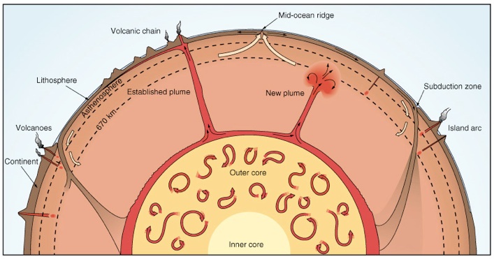
Flood basalts are the result of deep earth processes, events that probably originate in Earth’s outer core, a liquid layer of Earth which convects readily and heats the solid lower mantle. The lower mantle becomes hotter and more mobile, which results in mantle plumes that lead to partial melting of the upper mantle and Large Igneous Provinces (LIPs). Flood basalts are a big feature of LIPs.
Any individual place on Earth exhibits only tiny windows of Earth history. In the Keweenaw and Isle Royale, we can see into events that range from about 1.2 billion years ago until perhaps about 0.9 billion (Davis and Paces, 1990), and we can also see the deposits of the glacial periods of the last few million years. To see the record of other times we must travel to where we can see rocks of those ages are at the surface.
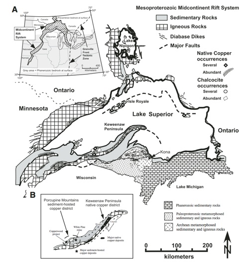
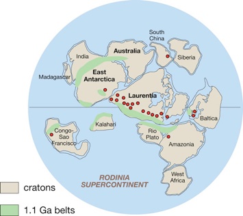
This is the very best place to see the exposed rocks of the midcontinent rift (left). This rift extended from at least Kansas to Detroit, but it is exposed only near Lake Superior. At the time of rifting there were huge differences in the configuration of the continents and a huge supercontinent, Rodinia, was assembled, a hodgepodge of pieces of what is now North America, Antarctica, Europe and South America. And it was beginning to break up.
In the Keweenaw we get a remarkable opportunity to look at rocks produced during the rifting period of Rodinia, which preceded the orogens shown in green in Figure 5. The orogens mark the areas where continental blocks approached each other at about 1.1 by ago. The orogeny in eastern North America, which eventually ended the Keweenaw Rifting episode, produced an orogen known as the Grenville Front. (Cannon, 1994).
Rodinia’s assembly acted like a great blanket for a large area of Earth’s surface, preventing heat loss and creating an opportunity for heat to build up underneath. A great hot spot formed under the blanket. The continent began to split with very hot dike swarms. When the splitting opened the rift, magma was erupted in huge amounts—a supereruption. The ancient Earth contained more radioactive heat producers so the potential for big eruptions was greater. We still think that most of Earth’s heat comes from radioactivity, and we still expect Large Igneous Provinces (LIPs) to develop when and where mantle hot spots occur. But perhaps LIPs are getting smaller as time passes and natural radioactivity declines.
Heat flow bottom line:
The Keweenaw Rift record shows how the earth has highly irregular deep seated convective events that help shape the planet. They come and go in time and space. Once the hot spot of the whole world, now the Keweenaw has heat flow that is far below average.
Local Rock Formations:
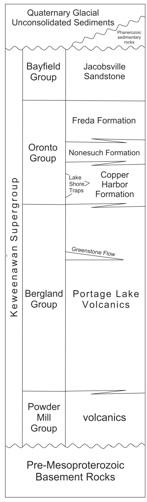
The diagram at right, from Bornhorst & Barron (2011), shows this mid-Proterozoic Keweenawan Supergroup, which contains all the formations of the rift. These consist of lavas from the deep earth and redbed sediments, shed off of the top of Rodinia into the gaping rift.
On Isle Royale, we find only the Portage Lake Volcanics and the Copper Harbor Conglomerate, while on the Keweenaw we have all the others.
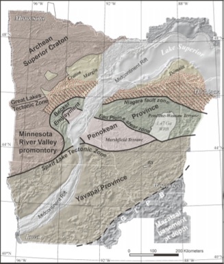
The map below shows the western limb of a feature called the “mid-continent gravity high” a linear feature that extends from Kansas to Lake Superior where it coincides with the Lake Superior Syncline. This feature is mostly completely invisible, but was detected by geophysicists working with gravity meters, who showed that the gravity attraction of earth to the instrument is measurably higher, indicating dense rock underneath. The map shown here has that buried dense rock region colored green. The dense rock could be the dense black lava flows we have in the Keweenaw, and their gravity shows that the rift was hundreds of miles long. Drill holes have penetrated the lavas in Kansas and Iowa, so we know that lavas are there--it is not just gravity detection.
The Lavas of the Portage Lake Lava Series are the result of a continental Rift, very much like the currently active Red Sea. Existence of a rift is a way to explain how such huge volumes of lava could have been erupted. It also helps explain the syncline we already proposed. A great crack across North America formed, stretching from Kansas to the UP and then on to Detroit.