


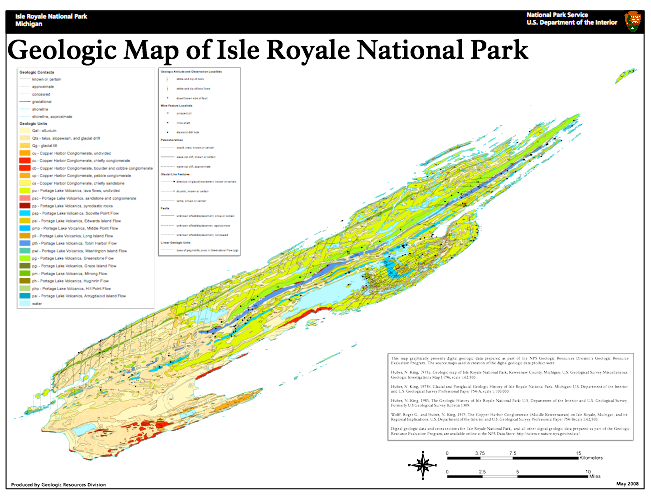
This field guide aims to give anyone interested in geology and Isle Royale an interpretation of things that can be seen outside in this unique National Park. We try to avoid jargon, in spite of some of the words above on this page. Each part of the earth’s surface offers part of the evidence of past events for us to interpret. These interpretations are speculative and they evolve constantly, reflecting new observations. On Isle Royale, the geologic map at the top of this page is mostly tan in color on its West 1/3, and mostly green on its East. The colors reflect glacial outwash gravels and moraines which mostly bury the bedrock in the west, while those materials are absent to the east. Because of our interest in the rift lavas, this trip focusses on the Eastern part of Isle Royale, although we do pass through Washington Harbor and part of the western portion. To understand the organization of this website, use the outline that follows
As part of its design, and in interest of its long term utility for visitors interested in geology, you are invited to tell us when revision is needed. Use my email: raman@mtu.edu
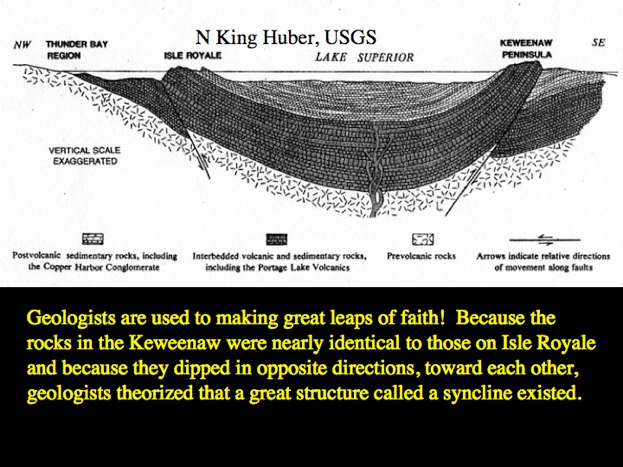
Much of the geologic background work on Isle Royale was done by N King Huber of the US Geological Survey, who made the geologic map above.
Download GPS locations we will visit (.kmz files)
Download: Field Trip Guide for printing
See map below for points of interest that we will visit or discuss as we pass them.
Low Lake Levels of Lake Superior
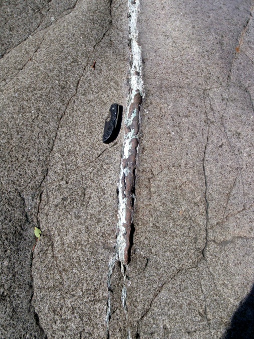
Native copper in a vein on Washington Island, Isle Royale (photo by Justin Olson). This occurrence of copper was found all over the Keweenaw and Isle Royale, but humans dug them out and made pits and small mines to extract the precious metal. It was traded across the North American continent by Native Americans. Later Europeans re-excavated the indigenous pits and eventually developed major mining activity. This mining of copper was an economic pay-off of a geologic event that brought deep-seated heavy elements to earth’s surface more than one billion years ago.
The wilderness preservation of Isle Royale may explain why such occurrences happen there but not on the Keweenaw, except in underwater places like Great Sand Bay.