 Back to Portfolios
Yellowstone National Park
Purpose: Advance GIS course Semester: 2nd (Spring) Date: January to April 2024 Softwares: ArcGIS Pro, QGIS, Erdas Imagine Mapping Skills: Least cost path analysis, Cost rasters, Temporal controller, Land cover change detection, Topological editing, Pan sharpeningYellowstone National Park - Potential Campsites and Trekking Trail Road
Clover-Mist Fire Timelapse
July 13, 1988 - October 1, 1988
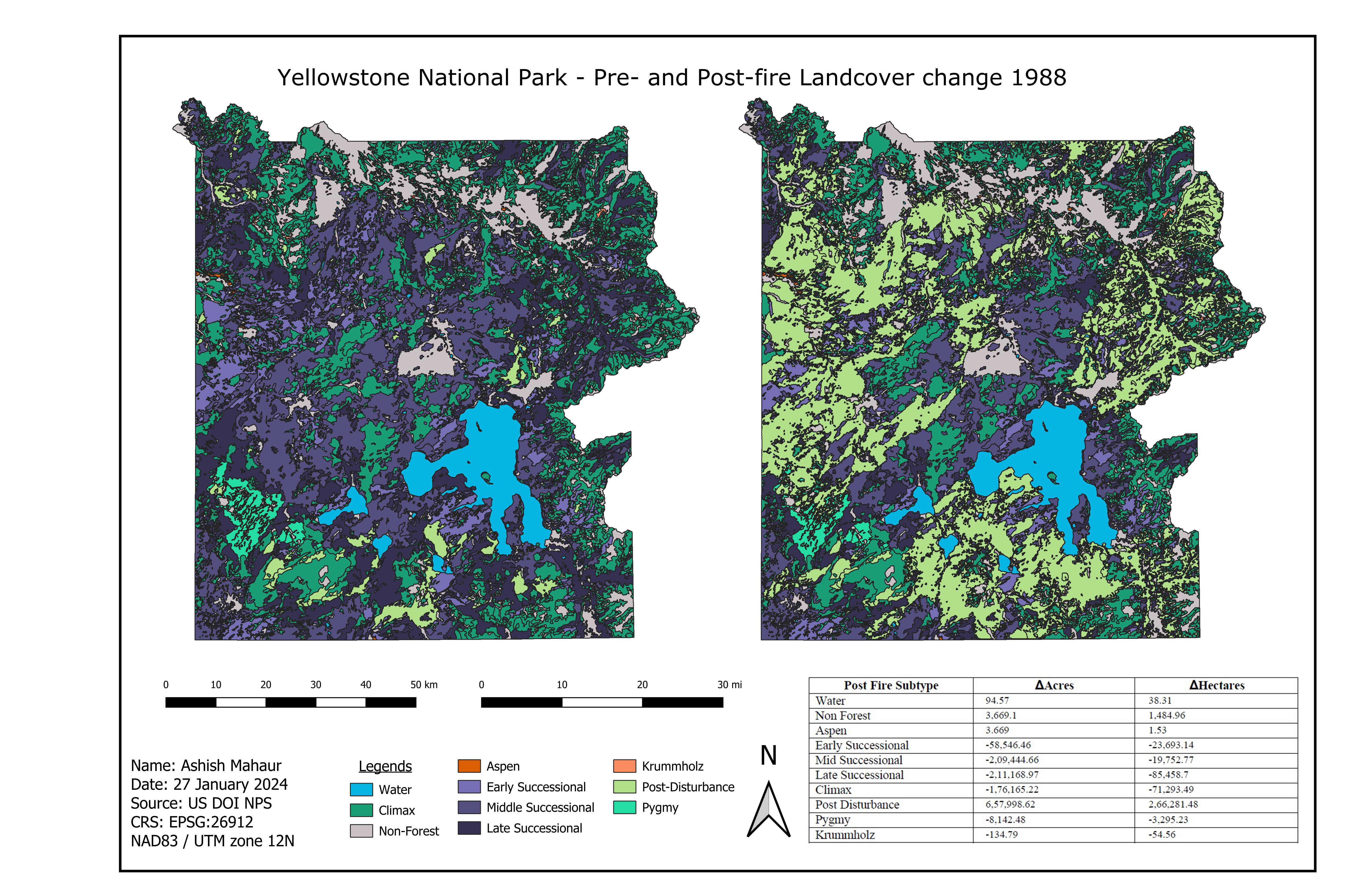
Pre- and Post- Fire (1988) Landcover Change
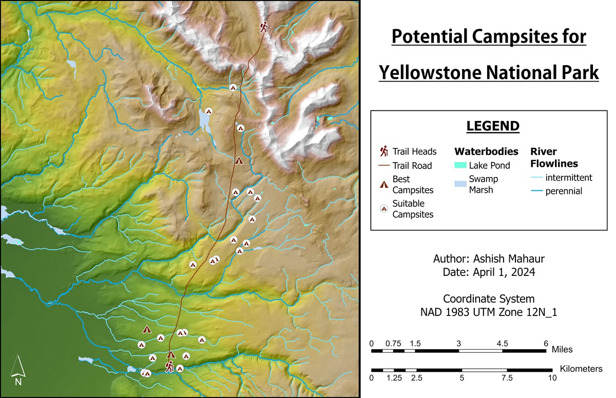
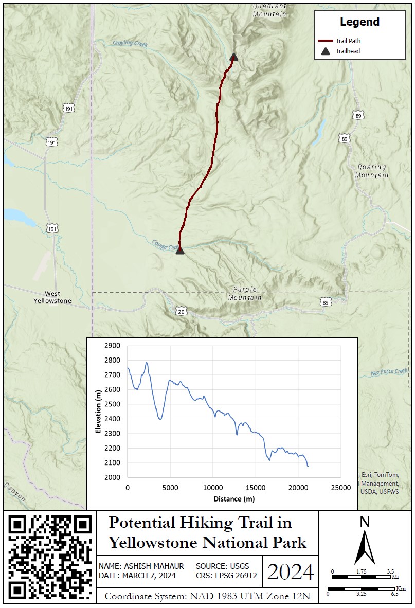
Potential Hiking Trail
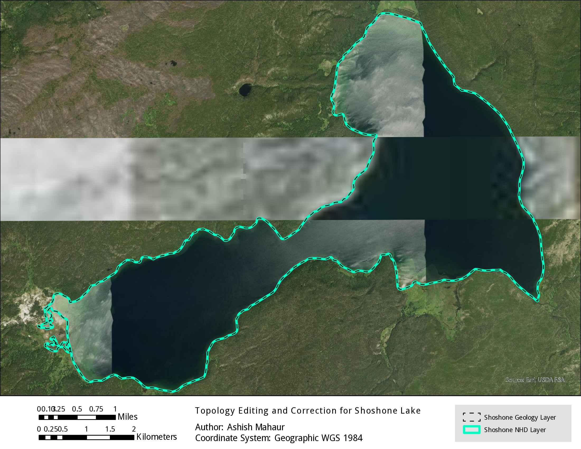
Topology Editing and Correction for Shoshone Lake
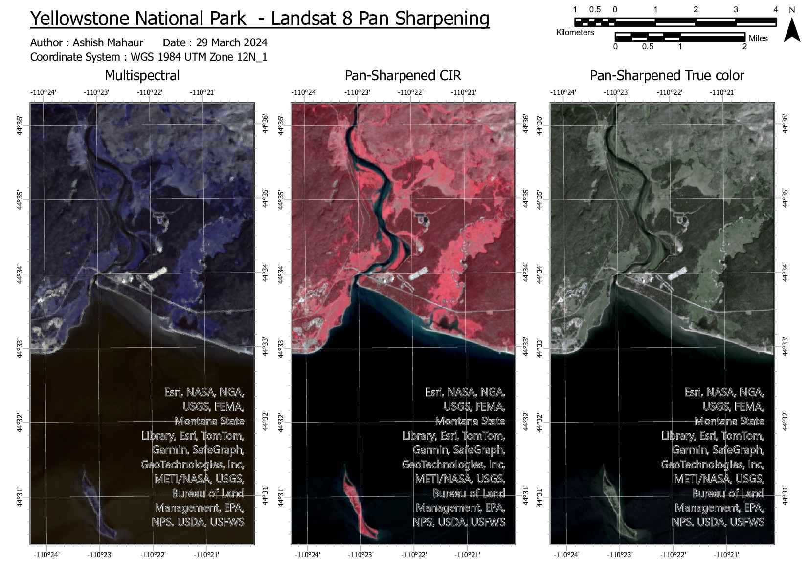
Pan Sharpening Excercise